A fine Spring morning beckoned back in 2014 and I decided that would be the day I finally got to Fort Darnet , a small island 8 or so miles into the Medway estuary and fortfied with a Victorian era fort.
High tide was forecast at 1.05 pm that day so I got down to Queenborough late morning, I wanted to use the last of the ebb to take me the half mile or so out of the Swale into the Medway.The day was promising to be a belter: A cloudless sky and a force 3 wind, a trip in sync with the tides, what could be better? I drove to Queenborough and set up my sailing canoe before launching onto the Swale.
 |
| On the slip at Queenborough |
Having come out of the Swale and still with the last of the Ebb tide I decided that rather then turning left into the estuary I would stick my nose out of the mouth of the Medway and take a look at what lay beyond: There be Dragons?
 |
| Grain tower on the mouth of the Medway |
I sailed up to the mouth of the Medway, I sailed past Grain tower, on now side on the other, on the isle of Sheppy was Garrision point, a former naval dock now a commercial port.The Thames Estuary lay to the left, to the right stretched the North Sea.
By this time the tide had turned so I started making my way up the Estuary, along Saltpan reach,passing the piers off the Grain power station...


....and past the massive cranes of the container terminal next door,

As I made my way further into the estuary I fell into company with a squadron of yachts. that came from the Medway and tacked at a bouy to head back towards whence they had come. Unfortunately I had forgotten to bring my jib which would of been ideal in the light winds and I was eventually overhauled!

 |
| Add caption |

Soon I was having to tack to avoid the long jetties of Bee Ness, Oakham Ness and Kingsnorth power station
 |
| Kingsnorth Power station & jetty |
Once past the power station Fort Darnett came into view, the channel takes a sharp right hand turn around it, creating a strong tidal eddy. On the southern shore of the island are a number of concrete barges , the tide and wind had carried me much faster then I expected and I wasn't sure that I would be able to land for a hour or so until the tide had risen. However in front of the barges a small stony beach was exposed with appeared firm enough to land on.
 |
| The barges on Darnett Fort |
 |
| The route through the barges |
There was a small canyon between two of the barges which offered a route to drag my canoe up onto firmer land ,where I could launch once the tide had turned. I stepped my mast and rolled the canoe through and up onto the grassy high tide line.
 |
| Through the canyon! |

The day was getting increasingly warmer, I got out of my drysuit, broke out my lunch and relaxed for a while enjoying the sites and sounds of the estuary.
 |
| Looking South East |
 |
| The view East towards Hoo fort. |
 |
| Looking South West towards Gillingham |
I then decided to explore the fort itself. The forts (Darnet and Hoo) were built in 1870s to protect Chatham naval docks with artillery and a chain boom hung between the two forts. They were built to hold 100 men but most likely were garrisoned with 20-30. The guns were decommissioned before the first world war but the forts were used as observation posts in both wars.
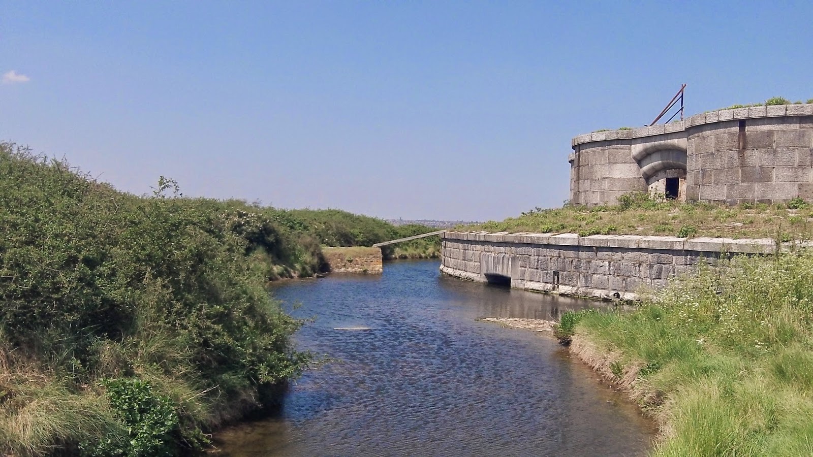 |
| Access to the moated fort is via the plank! |
 |
| Inside the fort vaults, note the gun port to the right and fireplace to the left |
 |
| In the middle of the fort. the remains of the flag staff are prominent |
 |
As I headed away from Darnet Fort a small cruiser had moored up on the concrete barges |
 |
| Out in the middle of the Medway |
Out in the middle of Medway at high tide I was miles away from any shore. Its always amazing how isolated you can feel out here, and remind yourself that you are still in South East England. As I crossed the Bishops Ooze I was struck by the advice on its marker buoy

As I got towards the end of the estuary I started looking for Sharfleet Creek, which runs between Burntwick Island to the North and Slayhill and Greenborough marches to the South. I got a bit lost in the myriad of channel and islands in the marshes as the leeboard of my canoe occasionally grounded I started to get a little worried, if the ebb tide might strand me on a mud bank till the next high tide!

As I made my way through the marshes I came across a solitary Seal basking in the spring sunshine. I eventually found my way into the creek and the deeper water. I made my way back to Queenborough.

I made a film of the trip which can be viewed here:
The following year I returned in much windier conditions to camp overnight on the Island the blog of which is here:
No comments:
Post a Comment